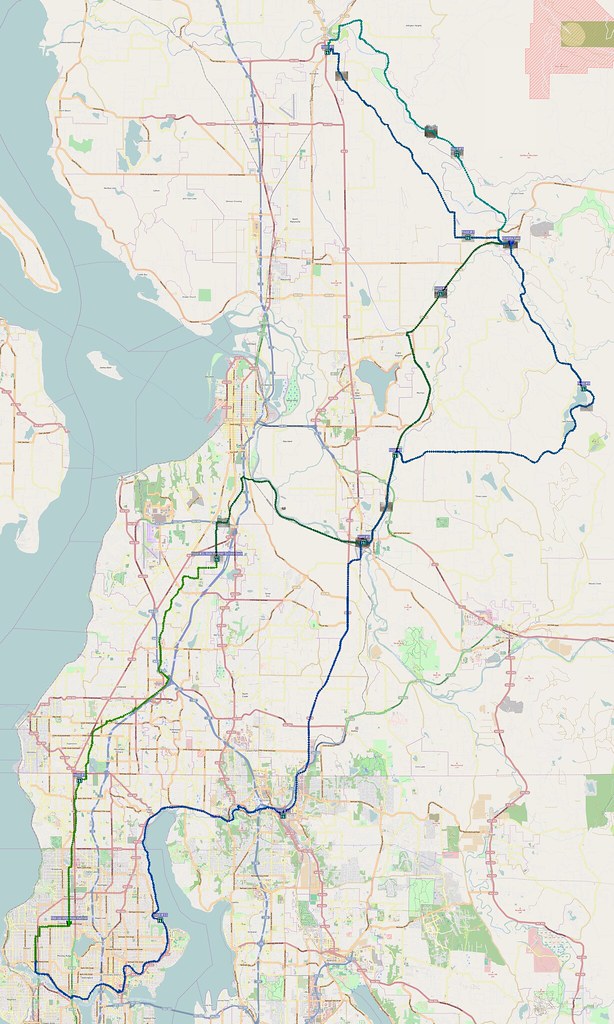
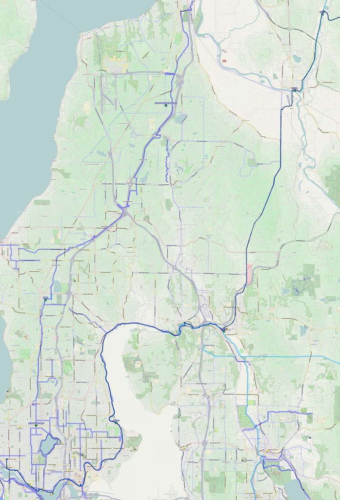
I had to use my GPS to generate a route, as I had accidentally loaded the wrong one. It rained constantly for the latter half of this ride.
Yesterday: 131 miles in rain and the Snohomish County foothills. http://t.co/AnZlCEQawU
— 竹下憲二 (@takeshita_kenji) March 9, 2014
More after the break…
Part 1: Familiar Route
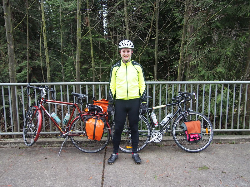
I started at about 05:00 and started along my normal route north of Seattle. Unlike most times, however, I met up with a riding partner at N 85th St. and Freemont Ave. N.
We chatted and rode along my route through Alderwood Manor, stopping to eat primarily for me since he would be breaking off fairly soon. While he knew of the northern Interurban Trail, he had never been along my choice route through the area before. He was also faster than me since he wasn't loaded down like I was.
According to him, the sprawl in Lynnwood is nowhere nearly as bad as in other parts of the US.
— 竹下憲二 (@takeshita_kenji) March 8, 2014
We separated in South Everett: I kept heading north while he headed back to Seattle to meet others for a previous engagement.
I had a riding partner from N 85th to Everett. He had to turn back due to a previously scheduled engagement.
— 竹下憲二 (@takeshita_kenji) March 8, 2014
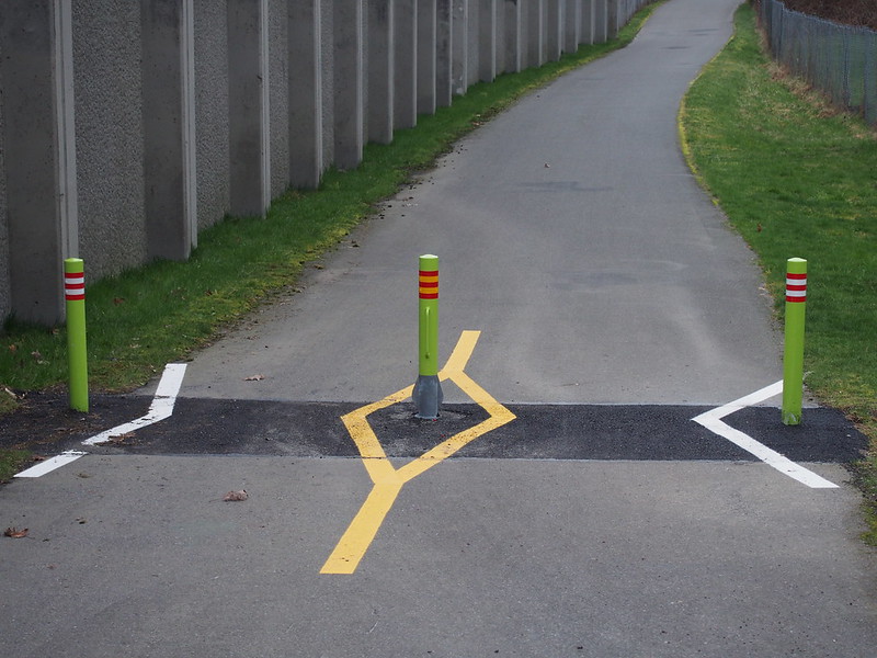
When I hit the Interurban Trail in Everett, I took a minute to photograph the bollards that replaced the poorly designed gates, which I noticed on an earlier ride.
My route took me along the low route to Snohomish.
And then along the Centennial Trail until Lake Stevens.
Part 2: Unfamiliar Foothills
I took SR-92 via Lochsloy to get to Granite Falls.
Wow, SR-92 sure is flat.
— 竹下憲二 (@takeshita_kenji) March 8, 2014
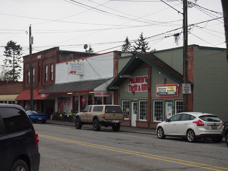
Granite Falls is one of the last towns on the way to Snohomish County's section of the Cascade Mountains.
I'm at City of Granite Falls (Granite Falls, WA) http://t.co/8NTewEayC5
— 竹下憲二 (@takeshita_kenji) March 8, 2014
@MAndersson1968 I'm pretty sure I found the restaurant at which we ate after hiking to Monte Cristo and the ice caves.
— 竹下憲二 (@takeshita_kenji) March 8, 2014
I took some photos on that hike, but I wasn't very skilled and was using a lower-end camera at the time.
And I could swear the shop below was an art gallery store thing back then.
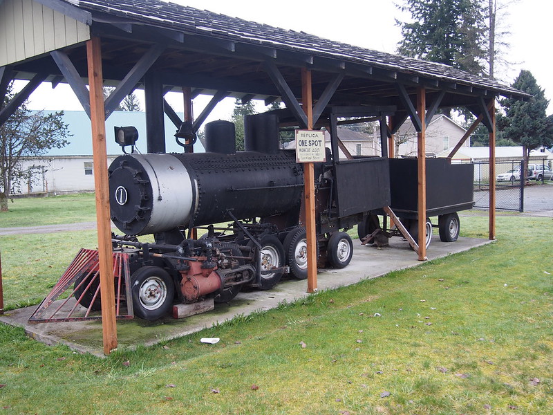
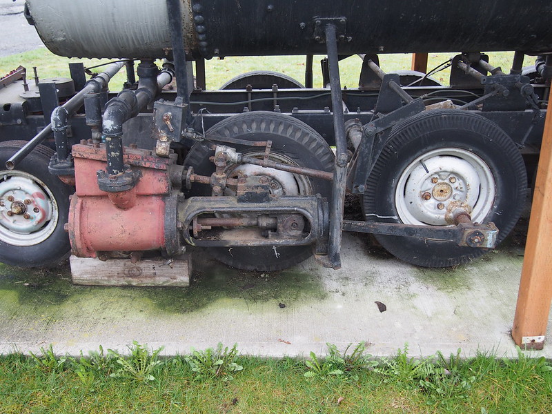
There's some freaky traction engine thing here.
— 竹下憲二 (@takeshita_kenji) March 8, 2014
It even had some form of valve gear!
I accidentally loaded the wrong directions onto my GPS, but I have a good recollection of my plan.
— 竹下憲二 (@takeshita_kenji) March 8, 2014
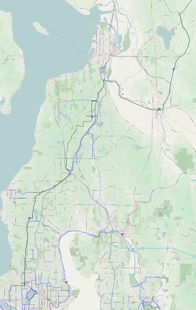
I noticed that my route had two parts instead of three parts, which caused me to be suspicious. When I took a closer look, I saw that this was my route plan to get to Barlow Pass (red line below).
My plan today certainly didn't include Barlow Pass!
— 竹下憲二 (@takeshita_kenji) March 8, 2014
I didn't end up following it exactly (blue/green spectrum both above and below is the actual track). The red line below was my plan. Looking at the topography, I want to check out that windy road just north of the one I took on the way home.
However, Jordan Road appeared to be the correct road.
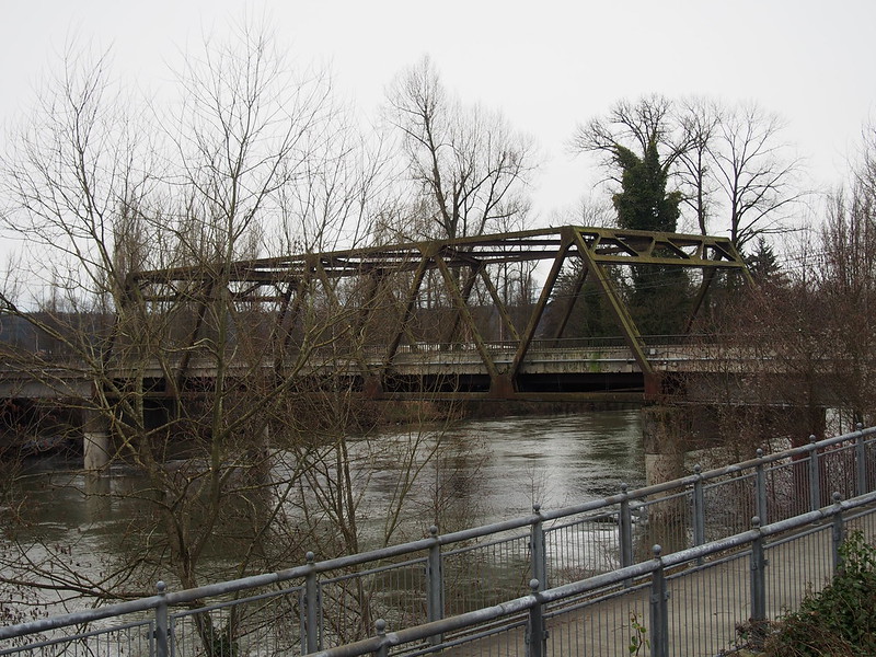
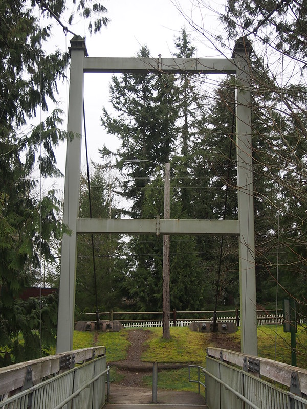
Along there, I came across a cool footbridge across the South Fork Stillaguamish.
I found this awesome footbridge across the South Fork Stillaguamish.
— 竹下憲二 (@takeshita_kenji) March 8, 2014
After that, I just continued to Legion Park, my usual stop in Arlington. This involved taking a bit of upper SR-530, which would be part of what would likely someday be my route to Darrington. It started to drizzle a tad here.
I'm at legion park (Arlington, WA) http://t.co/k52kdBM5k7
— 竹下憲二 (@takeshita_kenji) March 8, 2014
That wasn't so bad.
— 竹下憲二 (@takeshita_kenji) March 8, 2014
While my route to Arlington was along a valley, my chosen route back to Granite Falls would take me along ridgetops. This meant a major climb at the start.
It wasn't so bad once I got up there, though. It was mainly farms.
However, the hills started getting bad as I approached Lake Roesiger, the hills started getting pretty bad. The rain also got worse in the area, but it was nothing like recent times.
This is some pretty arduous riding up here.
— 竹下憲二 (@takeshita_kenji) March 8, 2014
There was actually a country store there, and there were little roadside signs for it around the area.
I wanted to photograph the lake itself, but it wasn't too breathtaking with so much rain in the air.
From there, I had some major climbs until I finally started the big descent into the Pilchuck River valley. I had originally intended to take a lower road between the lake and the valley in one direction, but I didn't have the proper route loaded. Maybe next time.
The roads around Riesiger Lake are graded very poorly.
— 竹下憲二 (@takeshita_kenji) March 8, 2014
I wasn't having too much fun between Granite Falls and Snohomish.
— 竹下憲二 (@takeshita_kenji) March 9, 2014
At least traffic was fairly light.
There were frogs or toads croaking all over when I was in the Snohomish County foothills.
— 竹下憲二 (@takeshita_kenji) March 9, 2014
I am very tired of dogs barking at me. #cycling
— 竹下憲二 (@takeshita_kenji) March 9, 2014
Dogs who bark at, chase, and attack cyclists are just poorly trained. They seem to be the majority. http://t.co/YBf7AM9zTC
— 竹下憲二 (@takeshita_kenji) March 9, 2014
I headed to my favorite coffee shop in the area to help me feel better.
Liquid resolve. (@ Rock City Cafe) http://t.co/8RYqVlI1yS
— 竹下憲二 (@takeshita_kenji) March 9, 2014
At least it is normal rain and not an utter downpour like last time.
— 竹下憲二 (@takeshita_kenji) March 9, 2014
Part 3: Return Home
I took my favorite route back from there: SR-9 to Woodinville. The drafting provided by the cars zooming by always helps.
After getting to Snohomish (and having coffee), the familiar SR-9 felt much better.
— 竹下憲二 (@takeshita_kenji) March 9, 2014
I'm at Wilmot Gateway Park (Woodinville, WA) http://t.co/7n1HYBtuXp
— 竹下憲二 (@takeshita_kenji) March 9, 2014
And I even got to the BGT before it got dark!
— 竹下憲二 (@takeshita_kenji) March 9, 2014
However, it did become dark soon after that. I had to deal with what I dislike about riding in the rain when it's dark out.
I really hate the glare the rain brings, especially when car headlights are involved.
— 竹下憲二 (@takeshita_kenji) March 9, 2014
Things seemed fine until I got to Lake City, but I started having some issues as I passed through there.
I lost the use of my largest chainring in Lake City. Need to get that looked at.
— 竹下憲二 (@takeshita_kenji) March 9, 2014
Apparently the issue with my front derailleur yesterday was just cable stretch.
— 竹下憲二 (@takeshita_kenji) March 9, 2014
I just stayed on the middle chainring for the remainder of the ride after that, but still tried to force it.
However, some work I had done by another shop on my rear shifter last July actually screwed it up some.
— 竹下憲二 (@takeshita_kenji) March 9, 2014
I recall side of the hood of that shifter feeling kind of funny after the repairs on 4 July, so that might've been the cause.
I got home a short while ago. I had to change out of my rain-soaked clothes.
— 竹下憲二 (@takeshita_kenji) March 9, 2014








No comments:
Post a Comment