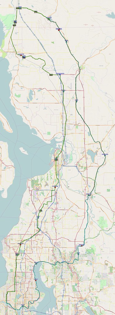
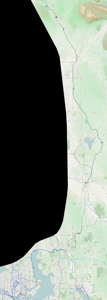
I took very different routes outbound and inbound on this ride.
Yesterday: 135 miles, with the latter half through a nasty storm. http://t.co/RkkdTlYF48 #cycling
— 竹下憲二 (@takeshita_kenji) February 16, 2014
More after the break…
Part 1: To Lake McMurray
I started at about 05:00 and headed straight north. It was fairly nice out at that point, albeit a tad cold.
After having my local bike shop fix up the issues from last time, I had very few problems. As always, however, the brakes demanded a lot of adjustment throughout the ride, but they seemed to be 'set' by the time I finished my ride later on .
Avid disc brakes take forever to get right, but they work so well once they are.
— 竹下憲二 (@takeshita_kenji) February 15, 2014
I saw some buses running the 'new' RapidRide E line as I rode along Shoreline's portion of the Interurban Trail, and I managed to get a photo of one at the northern terminus.
I recall seeing a large number of cats on the Interurban Trail in Mountlake Terrace. Thankfully, cats don't give chase.
— 竹下憲二 (@takeshita_kenji) February 15, 2014
I could swear that there was an old lady feeding them in the dark, but I still am not sure on that; she might've been doing something else.
As I've often done, I took the Manor Way/Admiralty Way route to Everett instead of sticking to the Interurban Trail past Lynnwood.
The weather gradually warmed up to comfortable levels by the time I reached Everett.
It was a bit cold earlier, but it isn't so much now.
— 竹下憲二 (@takeshita_kenji) February 15, 2014
As I've also found myself doing, I took SR-529 through Marysville and Smokey Point.
The first hour or so of riding is the hardest for me.
— 竹下憲二 (@takeshita_kenji) February 15, 2014
After the first hour, I've warmed up enough to get my body acclimated to the riding. Some folks would consider an hour to be a long time to ride alone!
Been fighting a minor northerly headwind all morning.
— 竹下憲二 (@takeshita_kenji) February 15, 2014
Looking back, I wonder if there really was a northerly prevailing wind at all. The easterly wind might've been playing tricks on me.
Exercise hormones always screw with my head.
— 竹下憲二 (@takeshita_kenji) February 15, 2014
The strenuous exercise reduces my mental capacity to the point where I focus on riding and pretty much nothing else. It's good because I don't get distracted, and that promotes happiness.
I was a bit startled when I found the decommissioned US-99 in Google Maps's directions. I wonder how that even got in there!
I then made a left on SR-530, and continued along its former route, called the "Pioneer Highway."
The Stillaguamish Valley's Pioneer Highway used to be a state route.
— 竹下憲二 (@takeshita_kenji) February 15, 2014
I stuck to the Pioneer Highway for quite some time, passing through Silvana and Stanwood. A recent time I was in the area, Google Maps took me on a route along a smaller road called, "Normal Road." On a more recent ride than that, I took Marine Drive and SR-532 instead.
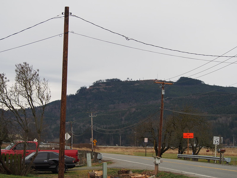
Something that caught my eye was this bit of road and bridge that must've formerly connected to the Pioneer Highway.
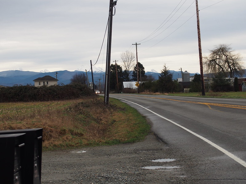
The Pioneer Highway suddenly became significantly better right after crossing north into Skagit County.
— 竹下憲二 (@takeshita_kenji) February 15, 2014
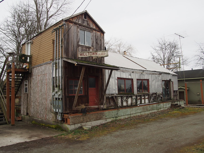
I then hit Milltown (too small for even a Wikipedia page!).
While stopping to take photos in a place called Milltown, an older woman came out of an apartment grafted to an old building and asked why…
— 竹下憲二 (@takeshita_kenji) February 15, 2014
…so many folks were stopping to take photos. She was fine with it and mentioned another collection of old buildings nearby.
— 竹下憲二 (@takeshita_kenji) February 15, 2014
She was really happy to have that little apartment, but always found it hard to hold conversations outdoors due to the busy highway and active railway line.
The sign in the above photo says "POP. 7."
The older buildings were down that 'primitive' road. I didn't want to risk anything with my narrow tires.
My last stop in the absolute northbound direction was Conway.
From there, I started heading to the southeast along SR-534, where I started feeling obvious headwinds.
The prevailing winds have actually been from the east all day, and I had to deal with them. Also, it's starting to rain a little.
— 竹下憲二 (@takeshita_kenji) February 15, 2014
And to Lake McMurray, which I consider to be the northern end of any Centennial Trail rides of mine.
I really like this place. (@ Lake McMurray) http://t.co/yNuIZQgwNm
— 竹下憲二 (@takeshita_kenji) February 15, 2014
The old Japanese lady remembered me this time, too.
— 竹下憲二 (@takeshita_kenji) February 15, 2014
I was really happy to see that she remembered. These little shops which are far removed from city life are so nice.
Part 2: Return Home
The weather is kind of like the big storm in January, except nowhere nearly as bad.
— 竹下憲二 (@takeshita_kenji) February 15, 2014
While it started off with reasonable levels of rain and wind, as I continued south, so did the weather. I followed the entire length of the Centennial Trail, save for around where I had my slide-out on an earlier ride.
After riding for a while, I just stop caring about rain.
— 竹下憲二 (@takeshita_kenji) February 15, 2014
When stopping for some pedestrians who were walking along the trail (there were cyclists coming the other way, albeit slowly), the chord of my brakes really resonated. Even I was surprised!
My brakes make different tones when applied while wet, so they make this cool chord.
— 竹下憲二 (@takeshita_kenji) February 16, 2014
I was going to tweet something but then I forgot. I guess I have rain on the brain!
— 竹下憲二 (@takeshita_kenji) February 15, 2014
While stopping to eat on the side of the trail, I was startled by a tree of about twice my height falling five meters or so away. Some folks asked if I had been okay after I mentioned it to them, but I told them it wasn't really near me.
Huh. That tree would've fallen on me if I had been standing a few meters closer.
— 竹下憲二 (@takeshita_kenji) February 15, 2014
I left the trail when I got to Snohomish and rode to the Rock City Cafe for a triple mocha.
One of my favorite coffee shops. (@ Rock City Cafe) http://t.co/wwppscQ2na
— 竹下憲二 (@takeshita_kenji) February 16, 2014
While there, I finally remembered what I had wanted to tweet earlier.
It looks like the Centennial Trail has also received bollard upgrades.
— 竹下憲二 (@takeshita_kenji) February 16, 2014
At this point, I'm not sure if it actually was upgraded, but it looked a lot like the upgrades to Everett's Interurban Trail section from earlier.
It's to the point where this kind of wind only bothers me so much.
— 竹下憲二 (@takeshita_kenji) February 16, 2014
Apparently there was a wind advisory in effect at that point.
Such is life. #cycling pic.twitter.com/ezNe9QUu5a
— 竹下憲二 (@takeshita_kenji) February 16, 2014
When I left the cafe, instead of sticking to SR-9, I took the parallel route which was familiar from my very first century ride. I stuck to the same road rather than deviating, as I recall riding in the area due to a detour on another previous ride. The winds were particularly awful up until I started climbing out of the valley.
Even though the road was lower than SR-9, it was quite a bit hillier. As I got closer to where I would cross SR-522, the rain started to absolutely pour. The noise kept me on edge more than anything. I recall trying to ride along the shoulder when it turned to gravel, which was really hard to see with the rain obscuring my view, the car headlights blinding me, and all of the pavement being equally dark. At that point, I avoided shoulders where possible all the way until Woodinville. At this point, it was even worse than January's ride due to it being dark.
I can't tell if I'm cycling or snorkeling at this point.
— 竹下憲二 (@takeshita_kenji) February 16, 2014
@takeshita_kenji You know that it's traditional for the swimming part and cycling part of a triathlon to be separate, right?
— Daggsy D (@DaggsyD) February 16, 2014
I was relieved when I finally hit Woodinville-Duvall Road as passed through the areas of Woodinville I knew. I think I'll just stick with SR-9 next time.
I finally got to the trailhead in Woodinville, feeling even more relieved as I would be off of the roads for almost the entire way back.
I'm at Wilmot Gateway Park (Woodinville, WA) http://t.co/UdOI7lF7p8
— 竹下憲二 (@takeshita_kenji) February 16, 2014
More fun with high beams. At least I'll be on a familiar trail for almost the entire way home now.
— 竹下憲二 (@takeshita_kenji) February 16, 2014
I'm not fearless; just stupid.
— 竹下憲二 (@takeshita_kenji) February 16, 2014
The rain died off between Bothell and Lake Forest Park. I was still fighting some nasty winds, though.
I like it when it isn't (1) pouring rain, (2) it gusting to dangerous, and (3) oncoming car headlights aren't blinding me.
— 竹下憲二 (@takeshita_kenji) February 16, 2014
I'm glad I have a touring bike and not a light road bike.
— 竹下憲二 (@takeshita_kenji) February 16, 2014
And in Lake City, I came across a large downed tree across the trail, illuminated by the headlights of a car from the road on the other side of the fence.
My goal has been to not have a tree fall on me. I seem to be doing a reasonable job so far.
— 竹下憲二 (@takeshita_kenji) February 16, 2014
I was really glad to finally get home after all that.
Bed plz.
— 竹下憲二 (@takeshita_kenji) February 16, 2014
Unfortunately, my soaked gear caused some really nasty abrasion where I rest on my saddle. There are seams in the compression shorts I've been using for the past several months, but they've never been much of a problem, even during January's soaking. I'm trying out new things since this ride.
Abrasion is a major problem when the rain keeps soaking everything. #cycling
— 竹下憲二 (@takeshita_kenji) February 16, 2014









No comments:
Post a Comment