I had high hopes for riding to Wilkeson and back, only for the weather to have other ideas.
While it started off well enough, a combination of rain, wind, and saddle position problems made this ride less than fun towards the end.
Related albums
More after the break…
Part 1: To Light Rail
Like usual, I started at about 05:00, However, due to the closure of the light rail through Downtown Seattle, I had to go all the way to SoDo to catch a train. While it was mildly annoying, it did give me the chance to try out the bicycle infrastructure being put in between the 2nd Avenue protected bike lanes and 6th Avenue S, which honestly wasn't half bad.
This closure is mildly annoying. (@ SODO LINK Station - @soundtransit in Seattle, WA) https://t.co/TiI9uIgSU3
— 竹下憲二 (@takeshita_kenji) October 26, 2019
Been a while since I've done this. Much more convenient than the bus when bags are involved. #cycling #seabikes #lightrail @ Seattle, Washington https://t.co/FK44cuGYRz
— 竹下憲二 (@takeshita_kenji) October 26, 2019
Part 2: Outbound
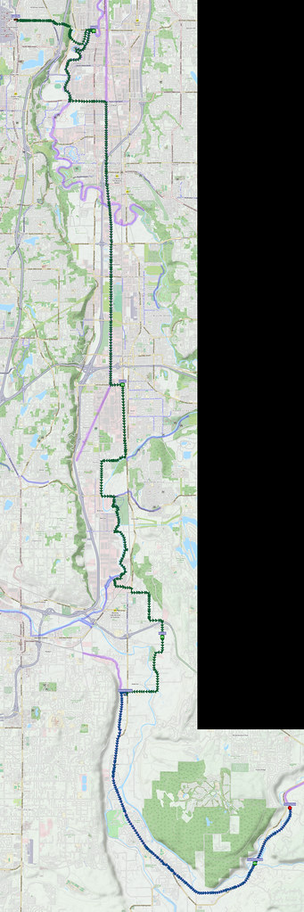
Unlike last time, I remembered to get off at SeaTac Airport Station, and was immediately faced with much more climbing than I would've faced if I'd left from Angle Lake Station. It ended up being worth it, though, as the descent didn't feature a hairpin turn.
While there were a couple of climbs immediately after leaving SeaTac Station, the descent was a lot more chill than the one from Angle Lake. I think this'll be my choice from here on out. #cycling #seabikes
— 竹下憲二 (@takeshita_kenji) October 26, 2019
After passing through an industrial park, I rode along the Green River Trail for a bit. It was a little spooky riding in the cool darkness in these fairly rural areas, without another person in sight once I was away from the roads. I switched to the Interurban Trail at S 212th Street, and discovered that  the gravel had been paved over, though the fences on either side were still present.
After leaving the Interurban Trail at 15th Street SW, I took the C Street Trail, then made my way through Pacific to the Sumner Link Trail, which was covered in leaves in many spots.
I left the trail in the business park north of Downtown Sumner in favor of skirting around the eastern edge of the city via 166th Avenue E to Alderton.
When I did get to Alderton, I discovered that Spooner Farms was having an Autumn fair, and tried to find some hot apple cider, but only ended up with a huge funnel cake.
Wasn't expecting this! (@ Spooner Farms in Puyallup, WA) https://t.co/QWnkSscERy pic.twitter.com/SciKOWOnsI
— 竹下憲二 (@takeshita_kenji) October 26, 2019
Got a funnel cake.
— 竹下憲二 (@takeshita_kenji) October 26, 2019
After leaving Spooner Farms via their muddy parking lot, I was finally on the Foothills Trail. While heading south along it, I discovered a sign that reminded me of a  past outage on the same trail.
Wouldn't be the first time on this trail. #cycling #seabikes @ Foothills Trail https://t.co/dPy30xLT6t
— 竹下憲二 (@takeshita_kenji) October 26, 2019
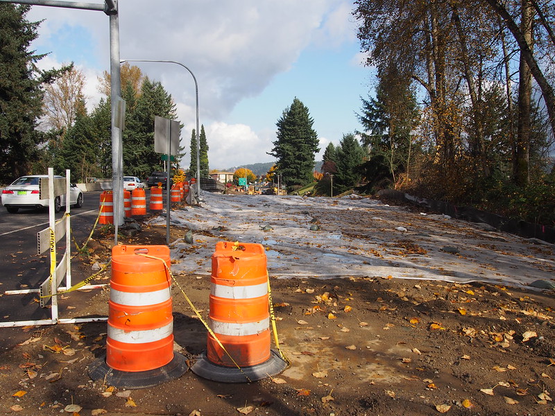
Since I wasn't headed that way anyway, I pressed forward. Another interesting change was the realignment of one crosswalk on the trail.
Pierce County has been making some minor changes to the Foothills Trail. Nothing really of note, though.
— 竹下憲二 (@takeshita_kenji) October 27, 2019
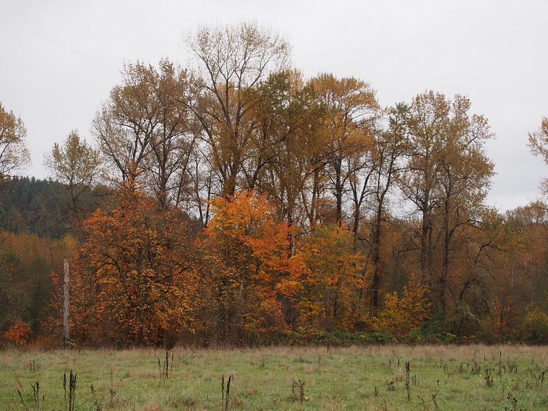
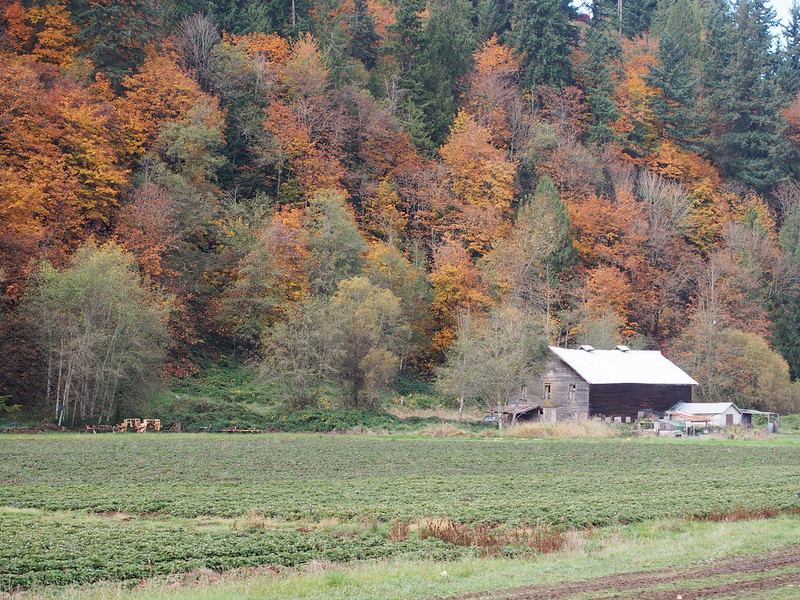
The leaves were also in full force.
Rain started falling a little past Orting when I stopped to eat, so I aborted the attempt and continued on in hopes of it letting up. While it did reduce some for a while, it started pouring much the same well before South Prairie. After seeing significant rain twice, I decided to give up and turn around.
Raining a lot around South Prairie. Had to turn back. #cycling
— 竹下憲二 (@takeshita_kenji) October 26, 2019
Part 3: Return via Sumner
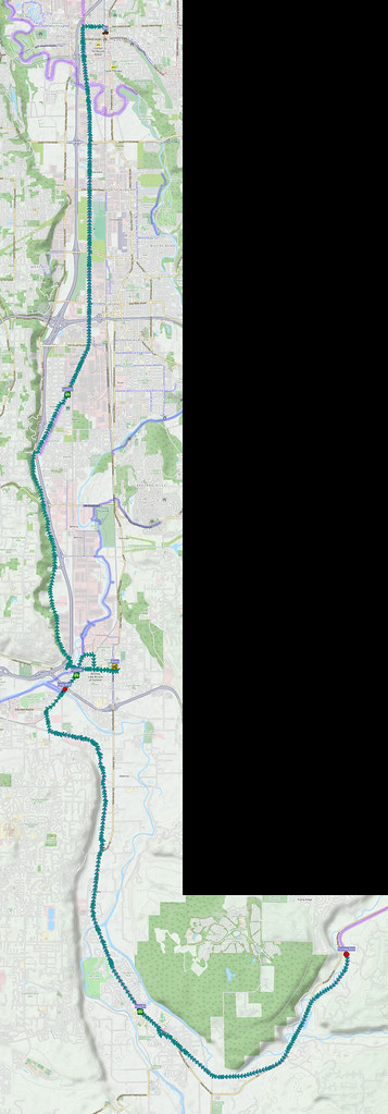
After looking for a nice indoor hot drink in Orting without success, I simply kept riding west and north along the Foothills Trail
Pretty crazy how sunny and warm it is down here, what with the rain further southeast.
— 竹下憲二 (@takeshita_kenji) October 26, 2019
After hitting the northwesternmost trailhead, I took Shaw Road E over the BNSF mainline, then E Main Avenue to Sumner.
I ended up stuck at the E Main Avenue/Traffic Avenue for several minutes while the traffic waiting for the light never ended up emptying after each cycle. I ended up needing to jump in on a yellow after the traffic stopped.
The SR-410 & Traffic Avenue interchange is incapable of handling the amount of traffic it sees.
— 竹下憲二 (@takeshita_kenji) October 26, 2019
Low on water, I headed to the local Fred Meyer to get more at the Starbucks inside.
I'm at Fred Meyer in Sumner, WA https://t.co/ENPB4zYksW
— 竹下憲二 (@takeshita_kenji) October 26, 2019
And then I simply left the ity via the new bridge over the White/Stuck River. After crossing it, I discovered that the city had used part of the  old bridge as art for the new bridge's park.
Sumner used parts of the old #bridge as a bit of art. Cute! #cycling #seabikes @ Sumner, Washington https://t.co/l8RzJOj5Hc
— 竹下憲二 (@takeshita_kenji) October 26, 2019
Heading north through the Green/White River Valley was a slog against a constant headwind. Likely due to the sugar from the funnel cake earlier, and the alcohol from the previous night, I was in a pretty bad mood at this point, too. After fighting my way all the way to Kent, I decided to give up and take the bus back to Seattle. It wouldn't be that simple, though, as a good portion of King County Metro's buses have bike racks that don't work with my Crust Romanceur because the hoop stabilizing its front lowrider rack, the front fender, and the randonneur rack combine to leave too little space for the bike racks' front arms' claws. After watching two buses roll by, the third one had a rack that had a smaller "finger" instead.
Taking the bus back from here. After everything else today, I'm too emotionally drained for this gusting headwind. (@ Kent Rail Station/Transit Center in Kent, WA) https://t.co/lc4322E3F4
— 竹下憲二 (@takeshita_kenji) October 26, 2019
No more drinking the night before a ride.
— 竹下憲二 (@takeshita_kenji) October 26, 2019
It's be nice if I could get some advance notice of what model of bus is on the way. This bike, with its annoying hoop over the front wheel for the lowrider rack, doesn't fit on a number of their racks.
— 竹下憲二 (@takeshita_kenji) October 26, 2019
Never getting a bike that requires that hoop ever again.
— 竹下憲二 (@takeshita_kenji) October 26, 2019
Part 4: Return Home
When I got off the bus in SoDo, a well-coiffed guy who was headed to Beacon Hill asked me if he was at the right bus stop while I reassembled my bike bags on the bike. I told him that the stop across the street was the stop he needed to be waiting at in order to head that way. Once my bags were all loaded up, I started on my way back north to home via 6th Avenue S and SDOT's new bicycle route.
The route SDOT is using to connect the 2nd Avenue bike lane with 6th Avenue S is okay. #seabikes
— 竹下憲二 (@takeshita_kenji) October 27, 2019
At the top of Dexter Avenue, my GPS raised the usual "Batteries low" alert, and I thought it would be a routine replacement. Unfortunately, the batteries I tried wouldn't work after multiple pairs, and I assumed the GPS itself had some sort of electrical fault, so I gave up on it and simply rode home.
Not only does my GPS no longer turn on, even with fresh batteries, several streets on SLU were closed due to construction, so I had to take a pretty dumb route through there.
— 竹下憲二 (@takeshita_kenji) October 27, 2019
This ride taught me a few things:
- Minimize alcohol consumption.
- Never drink the night before a long ride.
- Avoid refined sugar while out on rides.
I also later discovered that some of the same batteries didn't work in other devices. All of my NiMH rechargeable batteries are from the same AmazonBasics package, and only the ones that had never been used don't work anymore: the charger says they're full, but no devices can get power from them. Since they're probably expired as of writing this post, I ordered some higher-quality Panasonic Eneloop batteries and plan to toss the AmazonBasics ones.







No comments:
Post a Comment