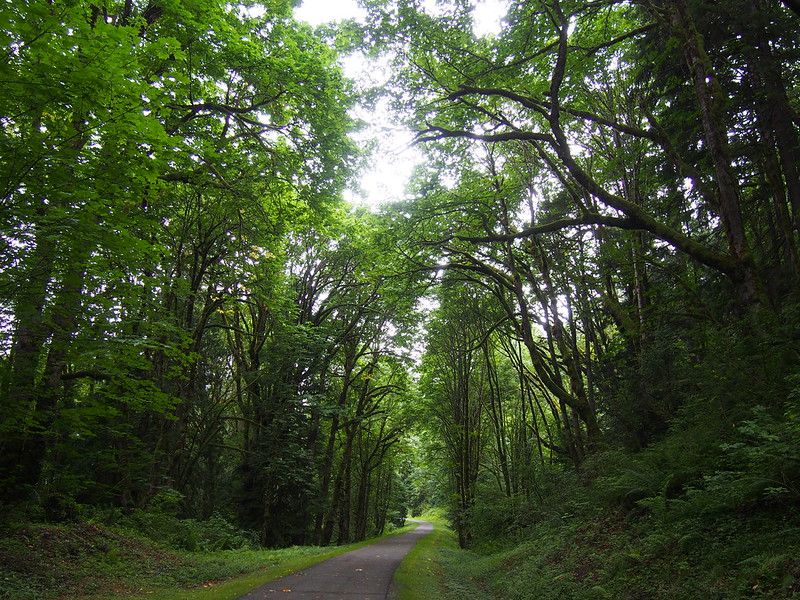
The road sure has changed since they paved it!
Related albums:
More after the break…
Part 1: To Bus
I left home at about 05:00 like usual. I had to make some detours on my way to downtown Seattle because of Fremont Solstice Parade preparations. While making the small detours, I thought that leaving early was a good idea…until I ended up with at least a 40-minute wait for the bus.
Glad I left early so the detours for the Fremont Solstice Parade wouldn't make me miss my bus.
— 竹下憲二 (@takeshita_kenji) June 22, 2019
While I was waiting, an older gentleman holding a cardboard sign kept talking about how much he liked my bike. The sign made me a bit uneasy since it looked a lot like the signs that local homeless people hold when panhandling at the side of the road, but I eventually could tell that he wanted a genuine conversation. He talked about how he always used to ride unicycles, and how he trained to get used to the 7' one. He said that when he fell off it, he wasn't wearing a helmet, but he didn't go to the hospital despite a likely concussion according to him. He stopped riding unicycles after that.
An older guy was telling me about how he used to ride a unicycle a lot when he was younger, including a 7 foot one. He was pretty impressed by my bike, too. #cycling
— 竹下憲二 (@takeshita_kenji) June 22, 2019
Got to the bus stop way too early. Oops.
— 竹下憲二 (@takeshita_kenji) June 22, 2019
While I was riding the bus, I caught a glimpse of the East Link Light Rail construction in the former I-90 express lanes. It was pretty cool to see that they'd gotten the tracks in along much of it already. It wasn't too long ago when the bus was able to use those lanes!
Pretty cool to see the light rail tracks in. Last time I was out here, they'd barely started working on them.
— 竹下憲二 (@takeshita_kenji) June 22, 2019
Part 2: To Middle Fork Campground
I thought about stopping at Panera for a hot breakfast sandwich like I used to do on cold days (though without coffee), but decided against it. Instead, I ate some food while stopped at Tibbetts Valley Park before heading out.
I'm at Tibbetts Valley Park - @cityofissaquah in Issaquah, WA https://t.co/jAxoZQvh6m
— 竹下憲二 (@takeshita_kenji) June 22, 2019
My ride through Issaquah was rather brief, as I headed straight for I-90 to save time getting to North Bend. While most people and even most cyclists would give me an odd look for taking that route, it's completely legal and serves its purpose.
Who recognizes this? #cycling #seabikes @ Tradition Lake https://t.co/QX4BiJmQca
— 竹下憲二 (@takeshita_kenji) June 22, 2019
The only major thing I dislike about riding on the shoulders of rural Interstates are the onramps and offramps.
— 竹下憲二 (@takeshita_kenji) June 22, 2019
The debris just means that one needs to be cautious just like on any other rural road.
— 竹下憲二 (@takeshita_kenji) June 22, 2019
Some drivers need to read this: https://t.co/LEs6vwQwyw
— 竹下憲二 (@takeshita_kenji) June 22, 2019
I was on I-90 well east of Issaquah when two trucks and a car decided to make some noise.
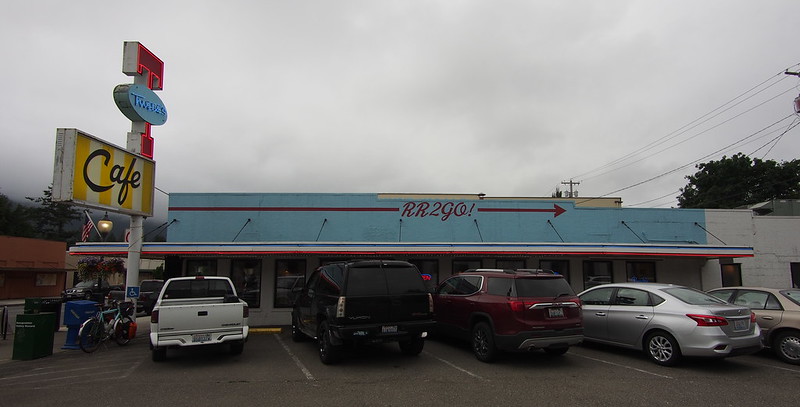
When I got to downtown North Bend, I stopped to get a photo of Twede's Cafe, a popular diner in town, when I saw andrew_squirrel loading up to head the other way. He said that he'd been out on a cycling trip since getting out of work on Wednesday, starting with heading out on SR-410 to cross Naches Pass and Tacoma Pass, followed by hitting the Palouse to Cascades Trail at Easton. I caught him as he was headed to Issaquah to meet friends, with whom he was going to hit up some mountain bike trails before camping at the Tolt-MacDonald Campground. We only chatted for a short while before he headed out on his way.
Ran into @andy_squirrel in front of Twede's. #cycling #bicycletouring #seabikes #bicycle @ North Bend, Washington https://t.co/o5P514dprS
— 竹下憲二 (@takeshita_kenji) June 22, 2019
I'd forgotten about the bakery in North Bend and had to get a doughnut there, and one for my partner since she'd be mad if I didn't get her one too. The water jug was too low for me to use it, so one of the staff brought out an already-filled pitcher of water for me to pour from.
#doughnut (@ Georgia's Bakery in North Bend, WA) https://t.co/THbyp9uCxG
— 竹下憲二 (@takeshita_kenji) June 22, 2019
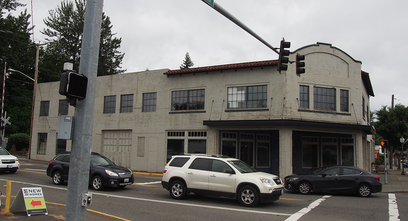
While riding through town, I noticed that they'd redone some of the main drag, with a raised intersection and bollards.
I left North Bend via North Bend Way/Tanner Way. According to bicycle maps, there's a trail beside it, but it peters out very quickly. Imagine my surprise when I saw another manicured (but still dirt) segment closer to the North Bend Public Works…which was also only a few hundred feet long.
The turn off of Tanner Way to the road to Middle Fork Road is pretty strange: it's nondescript and passes through areas of housing development, heavy equipment dealers, and lacks significant signage. I'd forgotten both that fact and the fact it was a false flat. While riding along it, I saw a Metro Trailhead Direct bus right before the first descent.
Here we go! #cycling #bicycletouring #middleforksnoqualmie @ Tanner, Washington https://t.co/oA0I8fSVln
— 竹下憲二 (@takeshita_kenji) June 22, 2019
This is probably a better "here we go" photo. #cycling #bicycletouring #bicycle #middleforksnoqualmie @ Tanner, Washington https://t.co/3s4punz9vs
— 竹下憲二 (@takeshita_kenji) June 22, 2019
The road passed by more scattered houses before descending further before hitting the Mailbox Peak parking lot, where some Forest Service guys were stationed at a booth. I asked them about the bus service since I had no idea it went out that far, but they weren't two informative beyond the bus stop sign. This was also the first place I recognized as having formally been gravel last time.
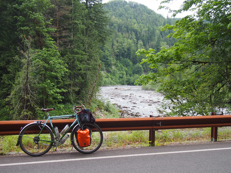
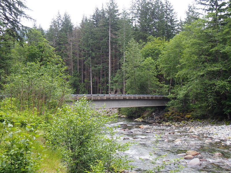
As I rode along Middle Fork Road, the stark difference in character from its past self made itself known. It certainly was never a rugged logging road, but it still had some allure to me back in the day. It was now much wider, with more rock cuts, guard rails, and improved brides all along it. I saw a lot of road cyclists making use of the smooth pavement, too.
The road definitely feels more civilized than it used to. I kind of miss the gravel, but at least traffic isn't crazy.
— 竹下憲二 (@takeshita_kenji) June 22, 2019
Seeing lots of roadies out here. #cycling #seabikes
— 竹下憲二 (@takeshita_kenji) June 22, 2019
At one trailhead, I saw two guys sleeping in their trucks, with their trucks' hoods up and the beds piled with all kinds of what looked like garbage: broken objects covered in dirt and rust, as well as fishing poles. Since their trucks also featured strong political opinions, I didn't stick around to take any photos near them.
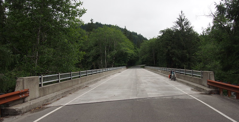
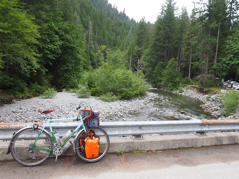
The big bridge across the river itself was largely unchanged from its past self beyond the missing gravel.
Nice. #cycling #bicycletouring #bicycle #middleforksnoqualmie #river @ Tanner, Washington https://t.co/QNmQXypBft
— 竹下憲二 (@takeshita_kenji) June 22, 2019
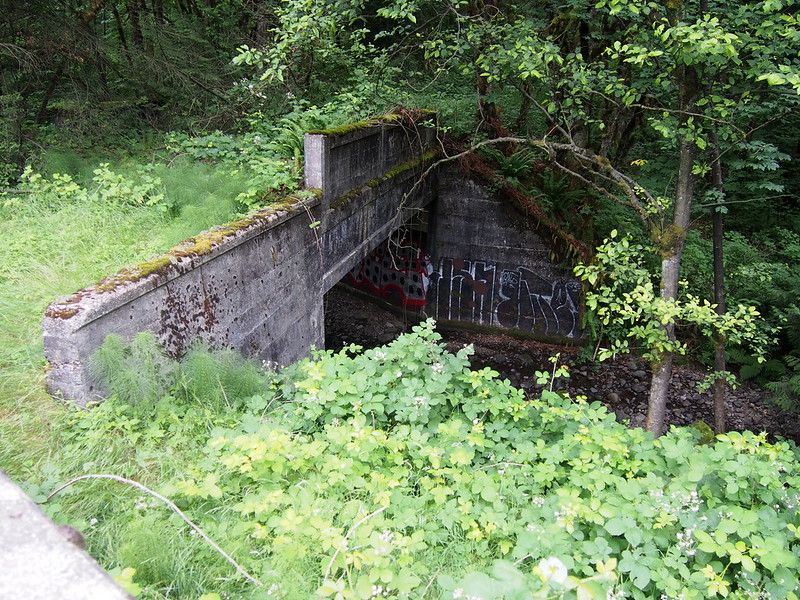
As I continued along the road, I crossed a bridge that freshly-built and even had a Bailey bridge bypass last time.
When I stopped to take a photo of a wooden bridge, an older gentleman was walking back to his car, also taking photos. Little did I know that I would encounter him several more times at stopping points along my route.
oOne interesting feature along the road were some dips in place to allow water to flow over the road rather than damaging it. There were drainage channels covered with grates at the center of the road so that normal flow wouldn't result in any water on the road at all.
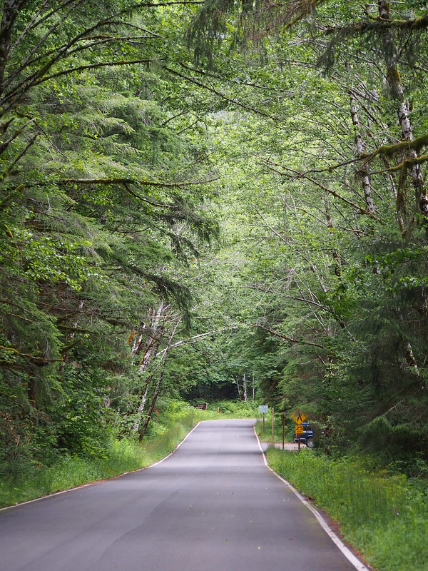
As the road approached the campground, it narrowed a bit between the trees.
While I did stop to eat at the campground, I didn't turn back quite yet. The same guy from before asked me what was beyond it. I told him that I knew of a 9% grade, and he said he saw the same, but decided to head back. After that conversation, I wanted to see what was really back there! After all, I'd only gone as far as the narrow Taylor River bridge last time.
With that steep gravel climb and the other option looking a bit unmaintained, I decided to call this trailhead my turning back point. Before leaving, I watched a Subaru Outback climb the steep hardpack.
The bridge was just as narrow as before, though the river looked wider.
Part 3: Return via Issaquah
While on the way out, I saw the same sign where I got a photo with my bike last time, but it was too overgrown this time for my mini tripod to work.
The descent was definitely noticeably easier than the already-easy climb up the river.
I eventually got to where they'd just paved last time, and the pavement was pretty rough. Time sure changes things!
So many Subarus out here.
— 竹下憲二 (@takeshita_kenji) June 22, 2019
After passing the Mailbox Peak parking lot again, I started getting a little worried about the climb back out of the valley. It wasn't bad at all.
I was afraid that climbing up from the Middle Fork Snoqualmie River into Tanner would do me in, but it wasn't bad at all. #cycling
— 竹下憲二 (@takeshita_kenji) June 22, 2019
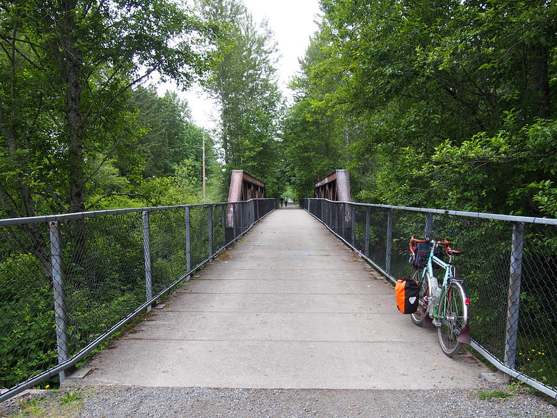
After a short bout on Tanner Road again, I was on the Snoqualmie Valley Trail. As I hadn't done any sort of gravel in a very long time, I was very nervous and white-knuckled for the first ten minutes or so. After calming down, I loosened up and enjoyed the change of pace.
It's been a long time since I've been on this trail. I haven't been on any #gravel in so long that I'd lost my gravel legs! #cycling #bicycle #bicycletouring @ North Bend, Washington https://t.co/DgNsGx4NA4
— 竹下憲二 (@takeshita_kenji) June 22, 2019
Not long after that, I remembered how rough the trail gets past the golf course, and that there's a stair climb at the end of it. Rather than dealing with that, I decided to leave the trail in favor of the road between the golf course and the local park. Before that, however, I was met with a surprise: there was a second "elk" gate at the north end of the trail's course through the golf course! I had no recollection of it, though it might've been there all along and I'd just forgotten. While I was stopped at the gate, I saw some cyclists also choose the road, and another one go through it.
I don't remember there being a second gate. #cycling #bicycletouring #bicycle @ Mount Si Golf Course https://t.co/TZWUq2DCis
— 竹下憲二 (@takeshita_kenji) June 22, 2019
The detour I'd chosen involves going through a fairly dead part of town and crossing a one-lane bridge with traffic lights.
After crossing the bridge and riding along Mill Pond Road, it wasn't very long until I hit the Salish Resort and Snoqualmie Falls.
I'm at Snoqualmie Falls Gift Shop in Snoqualmie, WA https://t.co/pfma1oxS14
— 竹下憲二 (@takeshita_kenji) June 22, 2019
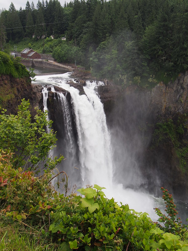
While trying to figure out my egress route, I asked the staff at the Snoqualmie Falls gift shop if there was a ramp to the pedestrian overpass, as I didn't want to have to try to make a left onto SR-202. I couldn't find it based on their directions, so I ended up lifting my bike up the stairs…only to see the ramp once I was at the top, which was where I decided to stop to take in the view of the falls.
Gotta love #cycling for visiting sites like this. #snoqualmiefalls #waterfall @ Snoqualmie Falls https://t.co/RJ8DzkJ9wq
— 竹下憲二 (@takeshita_kenji) June 22, 2019
While I took photos, a guy asked me about my setup with the front panniers. He said that he'd done some touring, and wished he had time for more, which is something I can definitely relate to. As an example of some of my past adventures, I pointed out the abandoned Northern Pacific trestle that's visible from the falls' viewpoint and told him about when I saw it up close by hiking along a trail that's closed to the public.
Once back on the highway, I took the usual descent into the valley, though the overgrown bushes on the side made staying in the shoulder pretty difficult. I was pretty glad to leave the highway at Falls City.
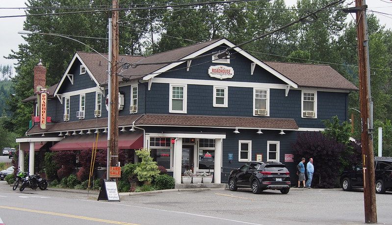
Cute place. #saloon #bicycle #bicycletouring #cycling @ The Last Frontier Saloon https://t.co/6BLuBvJzR9
— 竹下憲二 (@takeshita_kenji) June 22, 2019
While I at in town, a lady who just pulled in asked about my bag setup, and said that she used to tour more but hadn't done it for a while. During the conversation, I was kept amused by how this little burger joint spelled "fryes".
As I headed up Preston–Falls City Road, I saw a large group of cyclists obviously headed to join the Swift Campout, with the usual handlebar rolls, bags, and baskets. After leaving the road, I walked my laden bike up the steep climb to the trail, while another fairly normal looking guy rode his hybrid up it. I was more amused at how I was relegated to pushing than bothered by it. Once at the top of that climb, I hopped on my bike and rode my way up the trail. Not long after that, I saw another group of folks headed to the Swift Campout!
Once in Preston, I stayed on the unpaved High Point–Preston Trail, but then left it for I-90 due to how rough the Issaquah–High Point Trail is. It was at this point that I lamented the lack of a good bike route between Preston and Snoqualmie, as the options are either a rough climb up to the Snoqualmie Valley Trail, dealing with the narrow shoulder while climbing up SR-202 to Snoqualmie Falls, or using the shoulder of I-90.
Another trail I haven't been on in a long time. #cycling #bicycletouring #bicycle @ Tradition Lake https://t.co/lt4tRffSh7
— 竹下憲二 (@takeshita_kenji) June 22, 2019
The descent on I-90 was as quick as always, followed by a quick ride through town. One thing that caught my attention was that a four-way stop had been replaced with a traffic signal, which seemed odd as there never was that much traffic on either of the roads.
I've never unloaded the stuff from my bike as fast as that! The bus showed up shortly after I did.
— 竹下憲二 (@takeshita_kenji) June 22, 2019
I had barely stopped at Issaquah Transit Center for a minute before the bus rounded the corner. It took a second for me to realize that it was the one I needed, but once I did I started getting things off my bike…only to realize that I was at the wrong bus bay! After sprinting at top speed to the correct one, I got as much as I could off. The driver asked me if I wanted to get on, and I told her yes and asked if it was okay that it'd take a second to get one last thing off, and she said it was fine. I sure was thankful that I was able to catch the bus, as it saved me at least a half-hour!
While on the bus, I realized that I wasn't even sleepy. What a change from the norm!
Part 4: Return Home
When I got off the bus downtown, a couple of other guys were unloading their bikes as well. They were pretty impressed by my bike and asked if it had cameras, and were still impressed when I told them it was integrated lighting.
The ride home was pretty typical all the way until the Fremont Bridge, where I saw far more cyclists than I'm used to on the bridge's grates at that hour, likely due to the Fremont Fair. The crowds only got worse as I headed down the Burke–Gilman Trail, to the point where I had to walk a bit. Once free from the crowd, I was behind the same woman on the trail until I passed her by using my usual detour around the railroad crossing near Seattle Powder Coat.
Once I got home, I saw that I got an ad in my e-mail from Singletrack Cycles, which I was at earlier, before they opened, a fact that amused me.
While this ride wasn't super-long by my standards, I still had a good time with enough varied scenery to keep me interested.



























No comments:
Post a Comment